Take your first step towards the Career of your Dreams, Click here
Discover Indovance Download our Brochure
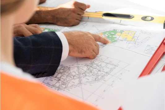
Successful and Sustainable land development is imperative for a community’s success. Technology has emerged as the key to not only enhancing our design and planning skills, but also the commercial feasibility of a project, innovative infrastructure solutions, and efficient utility management solutions.
Land Development and Master Planning Services are a crucial part of any Residential, Commercial, Industrial, Institutional, and Recreational development project, therefore effective development planning and drafting are critical for the precise construction of various projects.

Indovance has been providing specialized CAD drafting services for all aspects of land development and master planning since 2003. Two decades of experience and expertise in critical services of development and planning promise to give you faster and cost-effective design solutions when needed.
At Indovance, we comprehend each client’s, or project’s, requirements and suggest all-inclusive solutions to improve the design to suit the business objectives.
With the help of our experienced team and land planning expertise, we provide early feasibility analyses, due diligence, utility management, and a detailed site design with concept planning that can be accomplished in compliance with the standards and local codes and regulations.

A well-designed landscape; therefore, is the key to protecting the economy, the environment, and our overall lifestyle. We use a collaborative approach that works best when communication and decision-making are interactive.
The result is a design that fits your landscape and interior needs. At Indovance, landscape design and drafting services come at a reasonable price while maintaining the highest levels of quality and competence.
Indovance Inc. is a trusted partner for global companies for their design and drafting requirements, may it be for residential, industrial, or commercial project development. We can support you right from concept design to delivering accurate working drawings to be submitted to the local governing body. Our experts in the infrastructure engineering design industry have extensive knowledge of development policies, rules, and regulations of different regions which helps our client create accurate project designs.
Indovance has been providing reliable and cost-effective storm and sewer drainage services to global engineering clients for over two decades now. At Indovance we understand each customer’s distinctive requirements and provide them with customized services with a quick turnaround time.
Indovance Inc. will assist you with site grading plans as per your project’s requirements to ensure that your land development is available, drains properly, and complies with all relevant regulations. Our civil engineers can design a grading strategy that drains rainwater away from your building and neighboring properties while keeping the aesthetics of the landscape intact.
Indovance provides specialized urban planning and infrastructure engineering services to clients all over the world. We have some of the most qualified and experienced infrastructure engineers on board who can easily handle all your needs. We use the best and most up-to-date engineering design software and tools to ensure that our clients receive only the highest quality urban planning services.


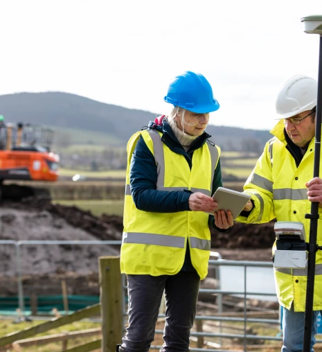

Land Surveying Services are the critical and precise process of mapping and representing the locations and details of features on a landscape or a facility on the surface of the earth by a land surveyor or a survey engineer.
Land Surveying drafting services lie at the heart of Reliable and Responsible land/site development. They determine the dimensions, distances, directions, angles, and elevations of the boundaries and characteristics of properties to accurately create plans. Thereby determining easements and intrusions/encroachments for the development of property and complying with local building codes and city regulations.
Indovance Inc. is a trusted and specialized CAD outsourcing partner catering to the survey drafting needs of the construction industry since 2003. At Indovance Inc. we focus on the client’s requirements and keen attention to detail to provide precise and high-quality CAD survey drafting services to our global clientele. Our focused and passionate team of 500+ engineers is highly skilled, experienced, and well-versed with CAD tools and experts in preparing accurate CAD survey drawings that are customized to the project’s location and comply with local standards and regulations
We combine technical innovation with deep domain expertise to deliver a comprehensive range of high-quality and competitive land survey and geotechnical engineering services to construction companies across the world

Geotechnical engineering services are a critical part of civil engineering because they assist in preventing problems before they arise. Structures might sustain considerable damage from an earthquake, shifting slope stability, ongoing settlement, or other effects without the sophisticated calculations and testing offered by Geotechnical engineering services. Any construction or land development project has a wide range of environmental concerns

Indovance Inc. is a multidisciplinary CAD studio. We collaborate with our clients to design, develop, and deliver work that we are proud of and that represents our passion for engineering. Founded in 2003, we have world-class development teams with deep domain expertise and project management skills that enable us to run a seamless, scalable, cost-effective offshoring model that turns complex business challenges into real business opportunities. We are more than just a service provider; We are a solutions provider for your growth and success.
We provide a wide range of specialized geotechnical engineering services that come at a competitive cost with quick turnarounds.
Always thinking ahead of what our clients might need down the road. Our aim is to continuously seek opportunities and capitalize on them to make the customer’s life easier, and our motto is "bringing customers specialized CAD services at their fingertips."
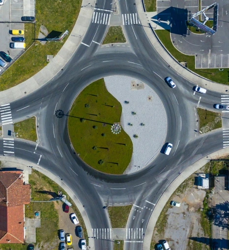
Transportation engineering and traffic planning is a subset of infrastructure engineering services that focuses on reducing crash frequency and severity. It employs physics and vehicle dynamics, as well as road user psychology and human factors engineering, to mitigate the impact of crash-causing factors. In order to connect people and places and promote economic development and growth, safe and effective roads are essential.
In order to create comprehensive master plans for zoning and road infrastructure, transportation engineering and traffic planning services
.webp)
Indovance provides a broad range of traffic engineering services to a variety of clients, including public and private real estate developers, governmental organizations, and civil institutions like universities, schools, national parks, etc.
Our cutting-edge traffic engineering solutions are offered against a backdrop of excellent safety studies, thorough traffic forecasts, transportation plans, etc., ensuring you never have to deal with subpar planning strategies in the future.
Indovance works with clients ranging from municipalities and DOTs to private developers to provide high-quality roadway design services for urban, rural, primary, secondary, and interstate roadways. Including interchange and intersection geometric patterns, utility relocations, traffic control, ITS, signalization, signing and marking, structural/bridge design, retaining walls, and related features, we are well-equipped to handle any task relating to roadway design.
Indovance offers clients the ability to maximize tight budgets while upholding performance standards and expectations thanks to our decades of pavement design experience. We produce pavement designs that offer affordable solutions to meet performance requirements. Clients gain from our experience and expertise, which includes managing major and minor projects for both public and private organizations across the globe.
A thorough analysis of the traffic dynamics is essential for creating robust traffic engineering plans. Our knowledgeable staff carefully examines each traffic component and uses the most recent transportation analysis software to design efficient traffic engineering solutions, such as highways, turnpikes, roundabouts, traffic signals, and other transportation systems.
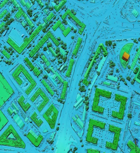
A geographic information system (GIS) is a form of digital mapping technology devised to capture, collect, control, analyze, and illustrate all types of geographical data.
GIS is a powerful tool for the visualization of data in a spatial environment and can be practiced in both problem-solving and critical decision-making processes. GIS (Geographic Information Systems) promotes holistic growth of municipal and urban development by providing insightful information that is being used to reveal deeper insights into data, such as demographic behavior, patterns, relationships, situations, territorial growth, customer trends, locations, utility mapping and more to make smarter.
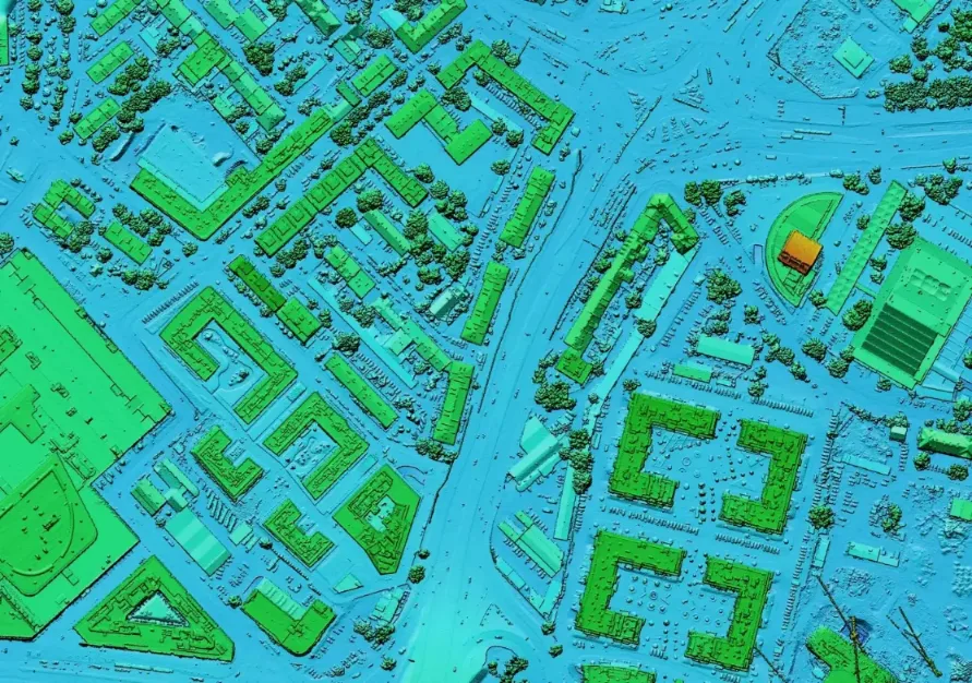
Indovance Inc. delivers an array of GIS Drafting services like geocoding, plotting points on Google Earth, mapping areas, CAD conversion services, etc. Our skilled and highly experienced staff are qualified to create GIS drawings with the help of cutting-edge software, tools, and research methodologies. Indovance provides all-inclusive GIS drafting services and supports our clients with GIS drafting services to present accurate spatial maps, cadastral maps, contour maps, atlas maps, landscape maps, environmental maps, and zonal and thematic maps.

Indovance Inc. has a rich AEC industry experience of two decades and provides specialized telecom network drawing services to the global clientele. We provide exceptional telecommunication network diagrams for superior telecom network planning and management. We have a team of experienced and expert engineers who utilize the latest tools and technology to create comprehensive, responsive, and informative telecommunication system plans that demonstrate how various items and components work and interact within a network to ensure effective end-to-end communication.
Basemap drafting is a critical aspect of the GIS industry. Our team has a good understanding of Basemap features, and local jurisdiction requirements with expertise in creating Spatially located Basemap features in GIS software